Which African country has the most beautiful map?

Tags 

  • Post In: African history

    • Keymaster
        #116

        All African countries have great-looking maps. These are among the finest African maps. In your opinion, which one of these country maps do you think is the most beautiful?

        Ghana map

        Ghana is a country in West Africa. It is bordered to the east by Togo, to the west by La Côte d’Ivoire, to the north by Burkina Faso, and to the south by the Gulf of Guinea. It has a total land area of 238,535 km2. Its rectangular-shaped map is beautiful.

        Togo map

        Togo is one of the sub-Saharan countries of Africa, also found in West Africa. Togo shares borders with three other countries in sub-Saharan Africa. They are Ghana to the west, Benin to the east, and Burkina Faso to the north. Togo’s map looks like a tree, having a crown and a trunk. It covers a land area of 56,785 km2.

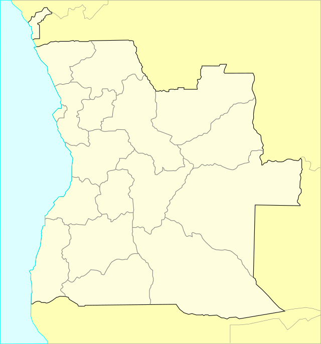
        Angola map

        Angola is in Southern Africa. It is bordered by Namibia to the south, the D.R. Congo to the north, Zambia to the east, and the Atlantic Ocean to the west. It has a total land area of 1,246,700 km2.
      • Keymaster
          #245

          La Côte d’Ivoire map

          La Côte d’Ivoire is also one of the countries in sub-Saharan Africa. It shares borders with five other countries in West Africa. To its northwest there is Guinea, to its southwest there is Liberia, to its north there is Mali, to its northeast there is Burkina Faso, to its south there is the Gulf of Guinea, and it is bordered to the east by Ghana. It covers an area of 322,463 km2.

          Benin map

          Benin is a small country in the West African sub-region. It is bordered to the northwest by Burkina Faso, to the northeast by Niger, to the west by Togo, to the south by the Gulf of Guinea, and to the east by Nigeria. It covers a land area of 114,763 km2. 

          benin map

      Viewing 1 reply thread
      • You must be logged in to reply to this topic.